Once upon a time, the human race thought that the earth was flat. If you sailed too far, you'd fall right off the edge and into who knows what.
However, as it turns out, our earth is indeed round. Like all of the other planets in our solar system, our spherical world twirls on its axis and orbits the sun, hurtling through space.
Mapmaking, or cartography, was first developed to help sailors navigate the seas. Civilizations have been drawing out images of spaces since essentially the beginning of time. However, this is a very difficult task because of the key fact that the earth is a sphere.
When you try to draw a spherical surface onto a flat page, the images get majorly distorted, and it is very hard to get an accurate depiction of what the world actually looks like. Three-dimensional globes do a pretty good job of fixing that problem, but when we need to look at a flat map of the world, that's when it gets tricky.
Luckily, with modern technology, Google Maps/Google Earth has created a page called The True Size that lets you see how distorted our flat maps really are.
I see the whole world differently after this — these 10 true size map images show just a few of the totally surprising things I found.
Please SHARE with your family and friends on Facebook!
Thumbnail Source: Pixabay
1. How Big Is The U.S.A. Compared To Greenland?
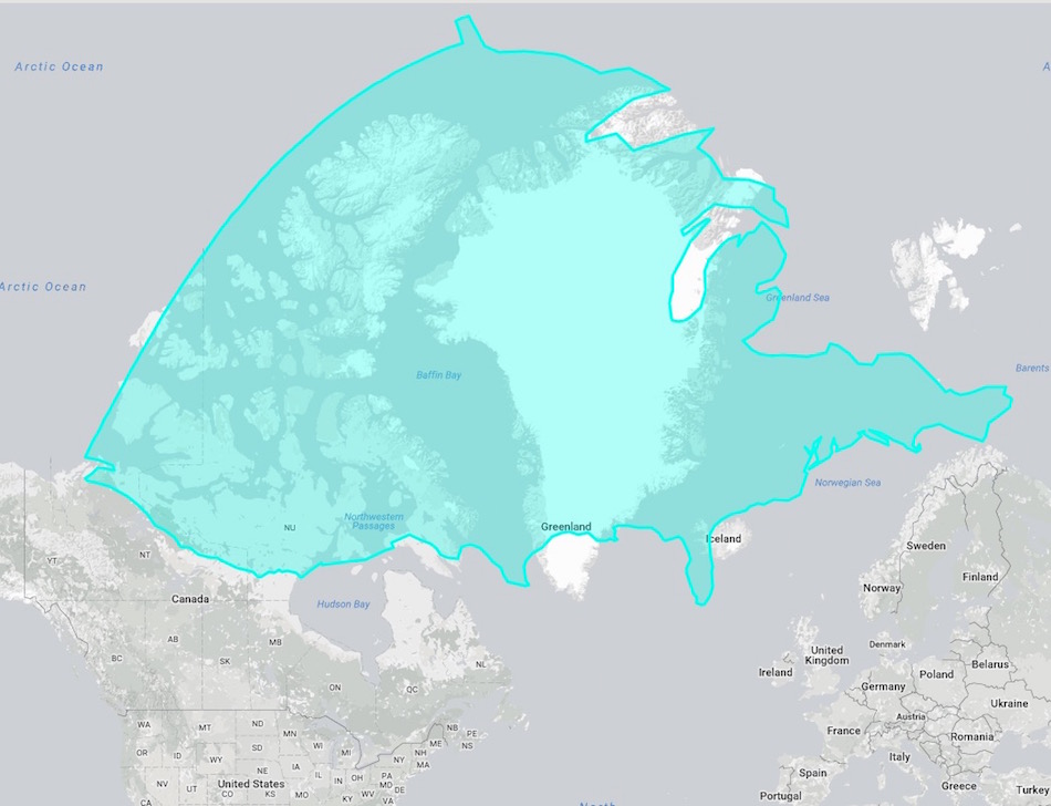
That teal blob is actually America, shifted just a little bit north and east. Although Greenland may dominate a flat map, the area of that island is 836,330 mi², compared to the 3,796,742 mi² that the continental United States takes up.
America takes up as much space as Greenland and Canada's Nunavut territory combined. Absolutely incredible!
2. Is Italy Really That Much Smaller Than The State Of Alaska?
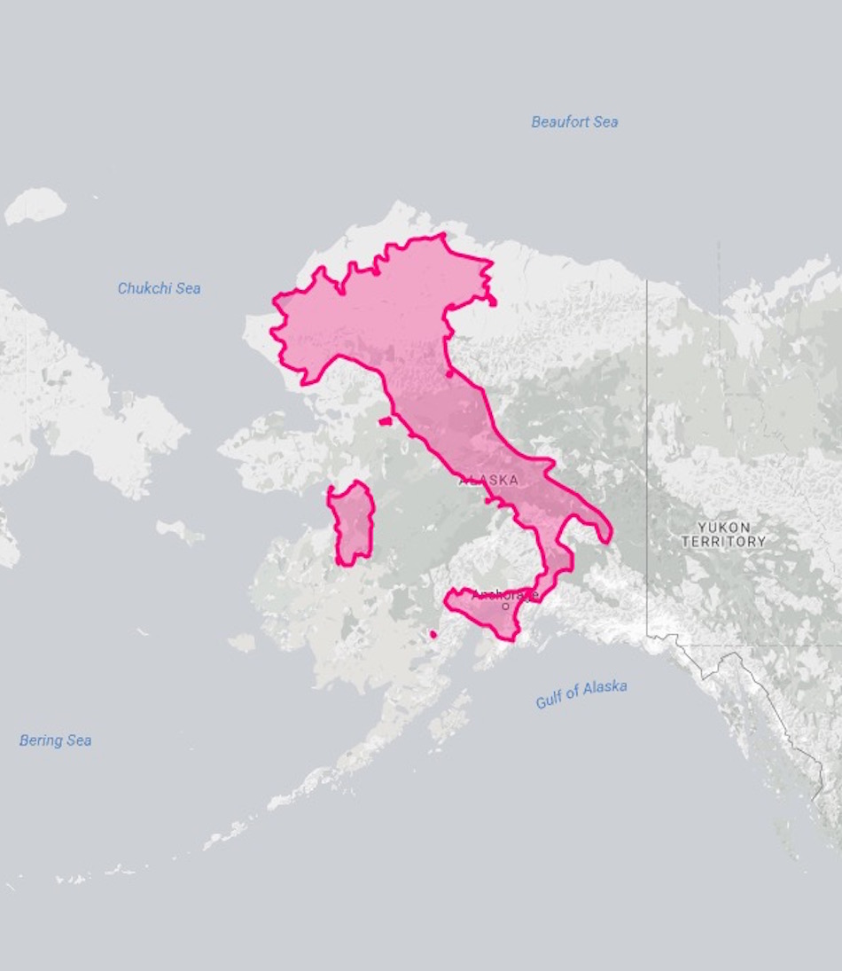
Italy (116,347 mi²), which is dwarfed on a map, fits just about perfectly when nestled inside the seemingly mammoth state of Alaska (663,268 mi²).
3. How Much Does Russia Shrink On The Equator?
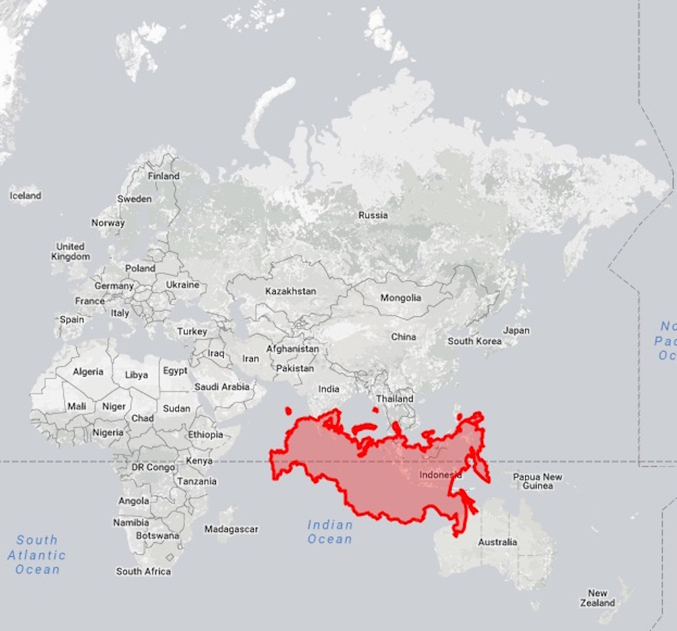
When you bring Russia down to the equator, you get a much more reasonably sized country. Yeah, it's the largest country on the planet at 6,592,800 mi², but it's not even twice the size of America.
The flattened map squishes Russia out to make it look much more expansive than it is.
4. Can You Guess Which Continent Actually Fits Inside Of Africa?
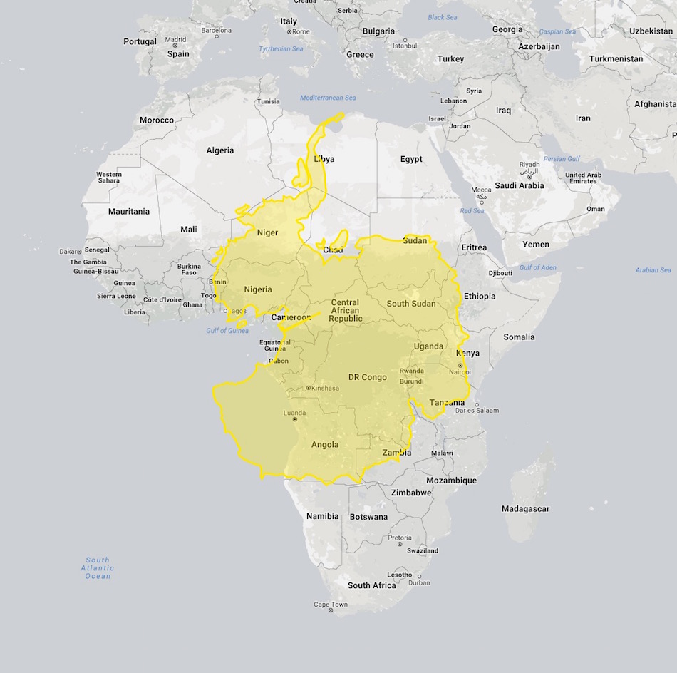
I'll give you three guesses as to what this yellow blob is on Africa. Go ahead, guess.
It's Antarctica, that giant, imposing sheet of white ice on the bottom of every two-dimensional map you've ever seen. Antarctica is 5,400,000 mi², compared to Africa's 11,730,000 mi². Man, the whole earth being round really made it hard for cartographers to depict our world on a page in a book!
5. How Big Do These Tiny Islands Look When Dragged To The South Pole?
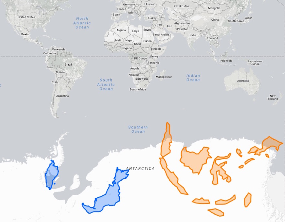
However, when you turn the tables and take the tiny countries from right on the equator, Indonesia and Malaysia, and plop them next to the southern pole on Antarctica, they all of a sudden turn into giant islands taking over the map.
6. How Many Times Does Iceland Fit Inside Of Greenland?
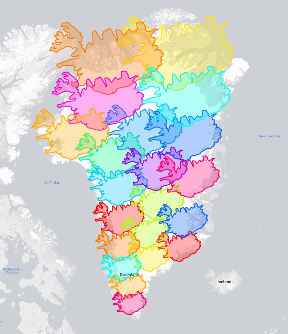
Now, just for fun, let's see how many Icelands we can fit onto Greenland, since everyone's always mixing them up left and right. By my count, the verdict is approximately 21 Icelands.
However, 260,000 more people live in Iceland than in Greenland, because Iceland is not made of ice, while Greenland is. Oh, boy, that's hard to wrap your head around!
7. Is Canada As Big As She Seems?
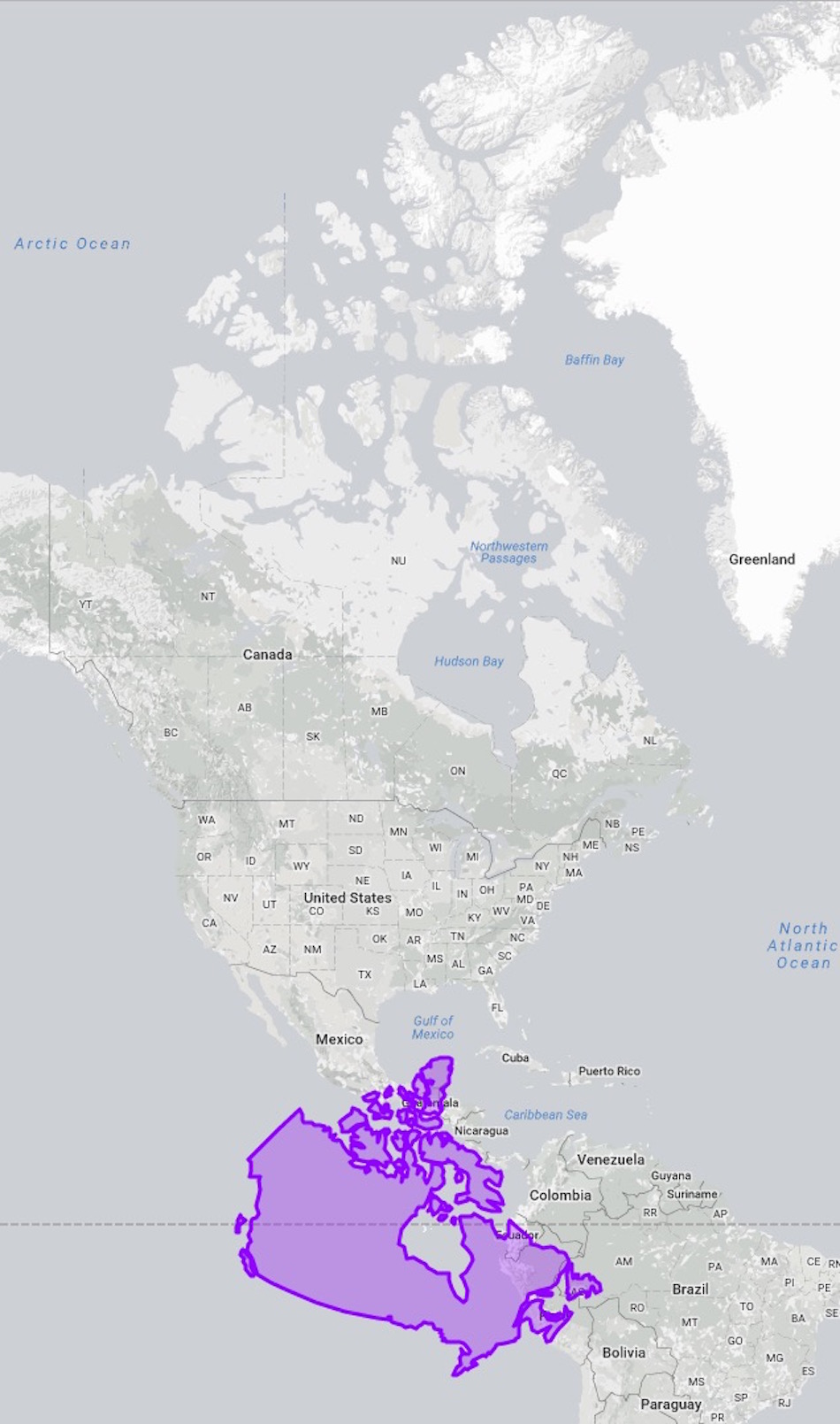
When we bring our dear friend and neighbor, Canada, down to the equator, her northern territories are stripped of their apparent two-dimensional vastness.
O, Canada, there is no shame in showing your true self!
8. What Would Cuba Look Like In The Arctic?
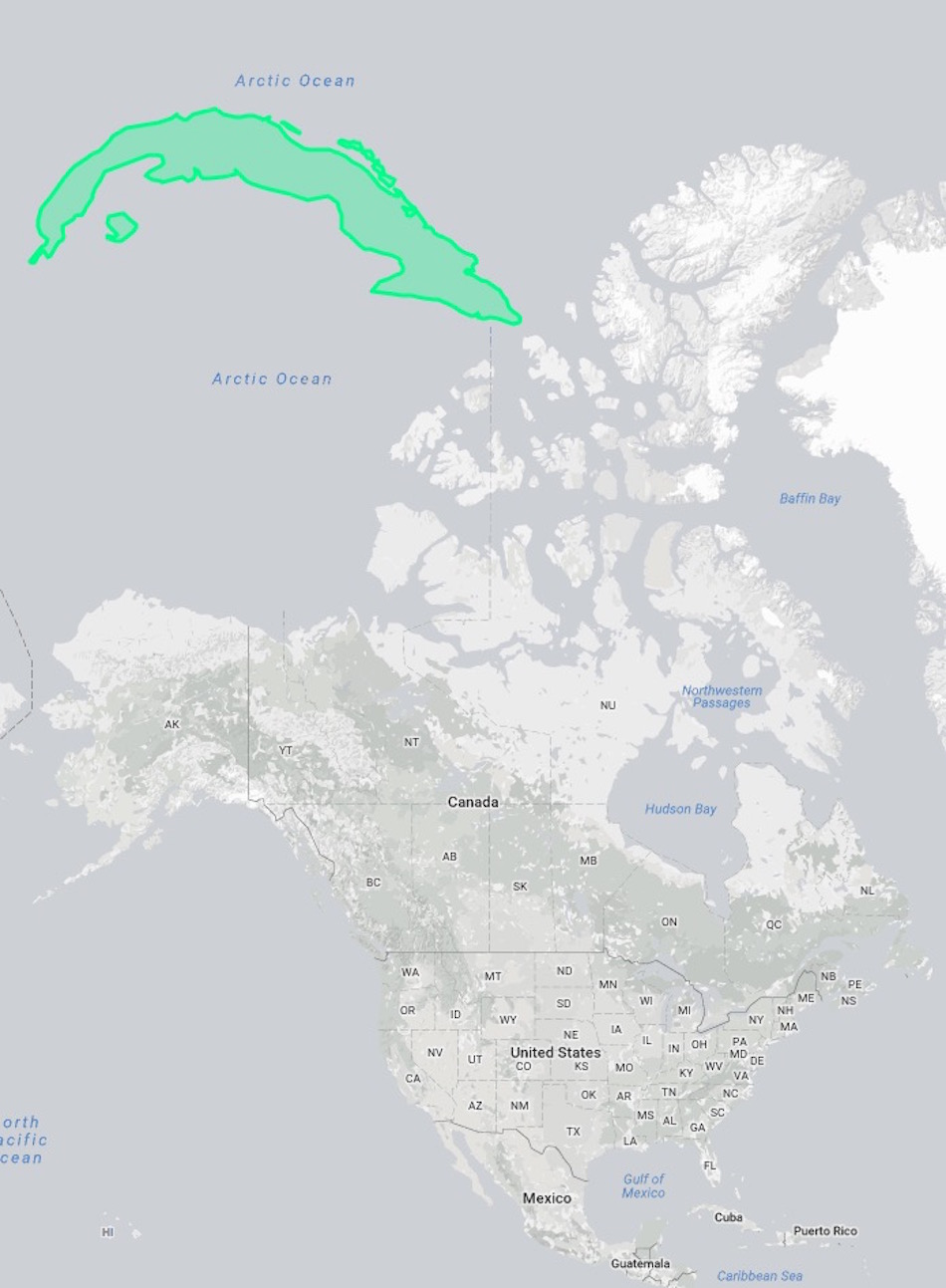
Cuba, the tropical island just 90 miles south of our very own Florida Keys, clocks in at 42,426 mi². That's pretty itty bitty, compared to America or Canada. However, if you plunk that little tropical island in the Arctic Ocean up north, she becomes a mammoth presence on the map.
9. How Different Are America And Australia Really?
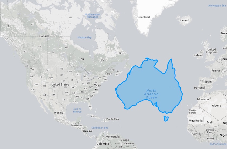
Australia is usually on the other side of the map in relation to America, so it's hard to see that we are close to being the same size. With America at 3,796,742 mi² and Australia at 2,969,907 mi², we're just a meager 828,835 mi² larger than the island.
Putting the two countries side-by-side helps make that clear.
10. How Does India Compare To Russia?
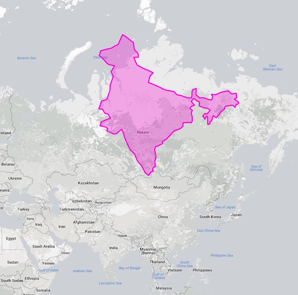
India doesn't seem so small when you move her 3,096 miles away from the equator and layer her on top of Russia, does she?
Will you look at maps differently now that you've seen these images? Please SHARE with your family and friends on Facebook!

